


Meet Japanese Companies with Quality
Mapping the Future of Autonomous Navigation Iwane Laboratories, Ltd. IP
Website: Iwane Laboratories, Ltd.![]()
Category: IT
- English
- Español
-
Hebrew
 (552KB)
Iwane Laboratories uses a pair of vehicle-mounted cameras to generate 3-D photographs that allow for easy, cost-efficient 3-D mapping critical to autonomous driving
Iwane Laboratories, Ltd. has worked with highway departments and municipalities to map over 25,000 kilometers of roads in Japan and other countries in Asia. The company is now applying its know-how to the development of 3-D maps for self-driving vehicles, using a process that is vastly cheaper and easier than laser-based mapping.
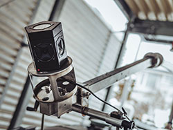
The company’s vehicle-mounted mobile mapping system generates 3-D images of the entire surrounding space.
Making Mapping Easier & More Accurate
Just as 2-D maps were key to navigation for human drivers, 3-D road maps will be indispensable in the age of self-driving vehicles, explains Waro Iwane, president and CEO of Hokkaido-based Iwane Laboratories.
While laser-based mapping systems can scan roadways to create 3-D maps, Iwane says such systems are sensitive to operate, generate cumbersome quantities of data, and yield surprisingly poor precision.
Iwane Laboratories’ Mobile Mapping System (MMS) uses patented CV (Camera Vector) technology and two vehicle-mounted cameras to photograph the surrounding environment at 16 frames per second. The system records spatial positioning information even as it generates extremely precise map data. “With our CV technology, the pictures that are taken are already 3-D images,” Iwane says. “This makes it very easy to create maps without having to go through a great deal of effort.” The high precision also makes the system ideal for difference extraction and object recognition functions.

Iwane Laboratories, Ltd. President and CEO Waro Iwane
Keeping map information up to date is also a snap: “Unlike with laser mapping, which is expensive to redo, our technology enables updating to be done at almost no cost just by driving the route again and using the new images,” Iwane says. And since the key to the process is the company’s in-house software, the entire system is easy to adapt to any future camera technology or particular local needs.
Protected Dimension
Iwane Laboratories has taken out numerous patents related to mapping with cameras and image recognition. Although it has licensed some of its technology in the past, Iwane says most of the patents are there to protect the company’s intellectual property, as well as to maintain its position as it explores new ways to leverage its technology.
The company’s focus is now on working with car manufacturers and other companies willing to invest in its technological development as it looks to applications in tourism, augmented reality (AR), emergency response and more—with a particular eye on needs that will arise around the 2020 Tokyo Olympic Games. Iwane further hopes to start a parallel business in Israel in 2019, with the goal of seeing profitability there by 2021.
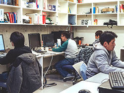
Employees developing software at the company’s Hokkaido headquarters.
1.2 million-kilometer Test Drive
Iwane’s goal over the next several years is to help create nationwide 3-D maps of Japan’s more than 1.2 million kilometers of roads in preparation for autonomous driving, which could in turn benefit other countries as well.
“We believe this technology could be a standard not only for Japan but for the world,” Iwane declares. It seems he has just the roadmap to get there.
Based on interview in January 2017

The company’s software, depicting images taken by the vehicle-mounted cameras.
Website: Iwane Laboratories, Ltd.![]()